Antiquarian Print Shop
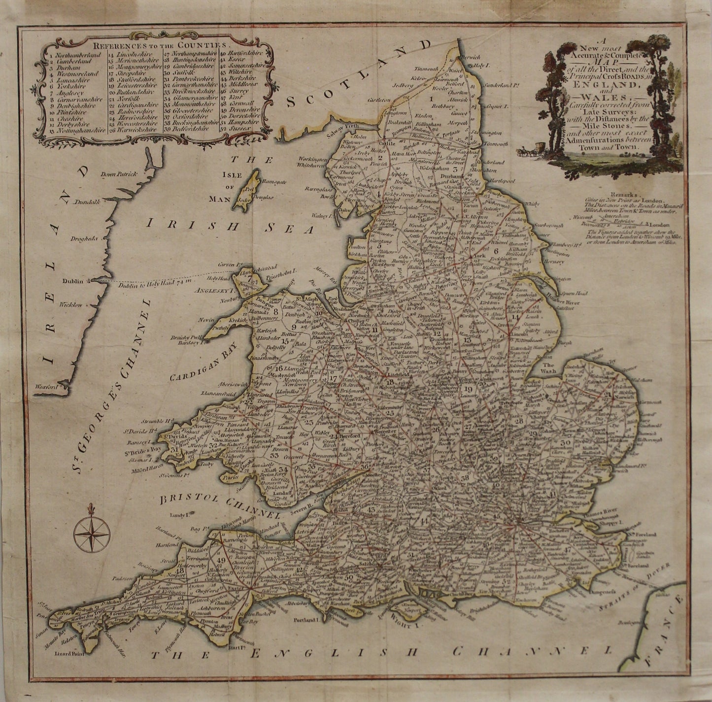
Map, England and Wales, With Direct and Principle Crossroads in England and Wales, 1750
Map, England and Wales, With Direct and Principle Crossroads in England and Wales, 1750
Couldn't load pickup availability
A new most accurate and complete map of all direct and the principal crossroads in England and Wales carefully corrected from late surveys: with the distances by the mile stones and other most exact admensurations between town and town.
Date: c1750
Paper Size: 370 x 365mm
Print Size: 345 x 340mm
Condition: Good
Technique: Copperplate engraving
Price: $950
Description: Good Copperplate engraving with later hand colouring
This map is a mid-18th-century equivalent of a modern road map, showing the major roadways and distances in miles between towns in England and Wales. Latitude and longitude are not shown on this map. When navigating by horse and carriage or by foot, the accuracy of mileage and general direction was all that was needed, as opposed to the precise co-ordinate placement that was so crucial for seafaring navigators.
Share