1
/
of
1
Antiquarian Print Shop
Map, Tallis John, Australia, c1851
Map, Tallis John, Australia, c1851
Regular price
$1,200.00 AUD
Regular price
Sale price
$1,200.00 AUD
Unit price
/
per
Taxes included.
Shipping calculated at checkout.
Couldn't load pickup availability
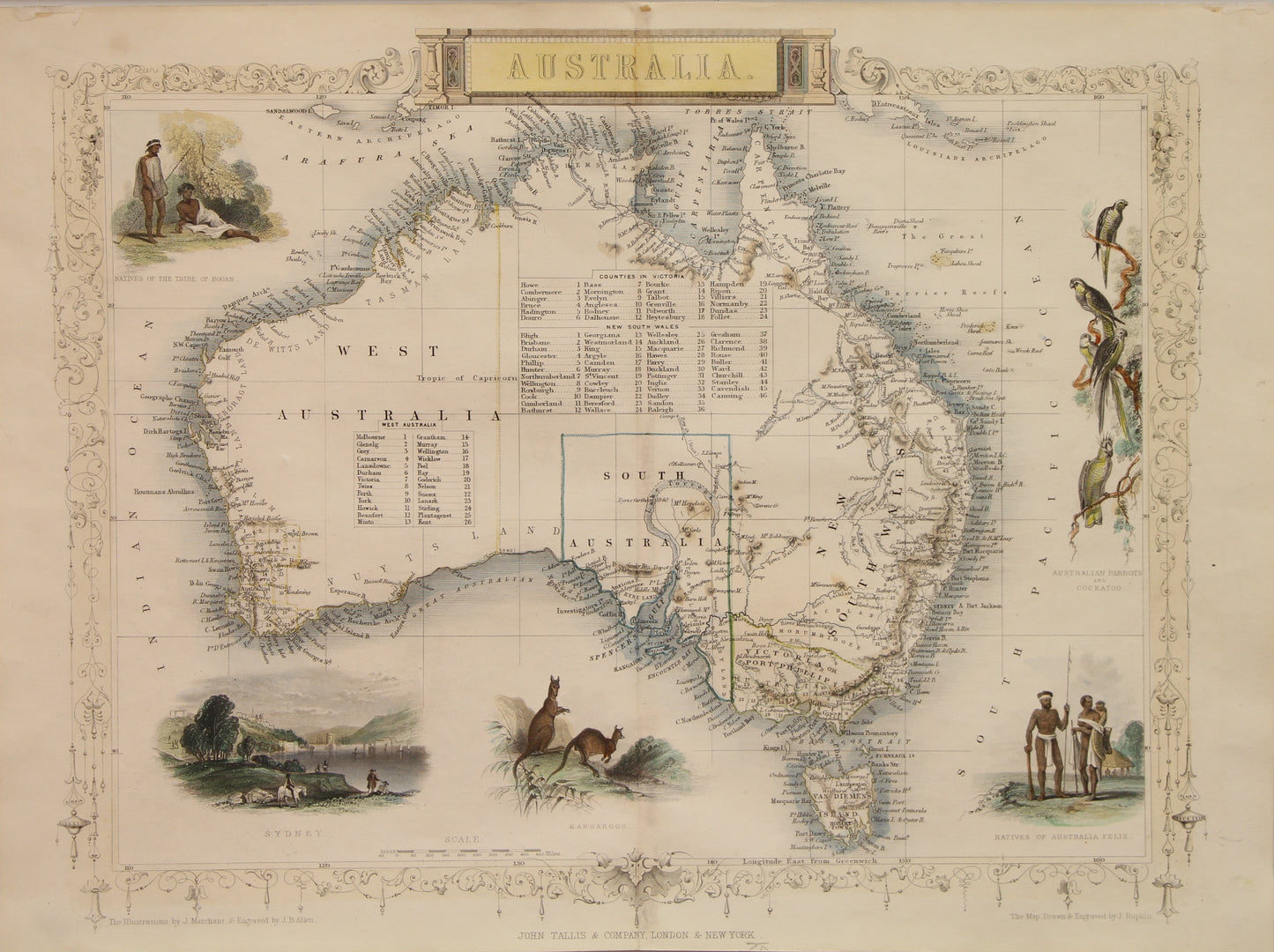
Original Tallis Map of Australia
Date: 1851
Artist: John Tallis
Engraver: J Rapkin
Image Size: 270 x 360cms
Condition: Excellent
Technique: Steel Engraving, later hand coloured
Price: $1200
Description: Original Tallis maps were issued uncolored. It was not uncommon for 19th century libraries to commission colorists to "complete" the atlas.
Due to the decorative style of Rapkin's work, many regard Tallis maps as the last bastion of English decorative cartography in the 19th century. Tallis Maps were characterised by decorative borders and vignettes on each map
Biography: Tallis, John, Cartographer
John Tallis and Company published views, maps and Atlases in London from roughly 1838 to 1851. The principal works, expanding upon the earlier works of Cary and Arrowsmith, include an 1838 collection of London Street Views and the 1849 Illustrated Atlas of the World. His principal engraver was John Rapkin, whose name and decorative vignettes appear on most Tallis & Co. maps. Due to the decorative style of Rapkin's work, many regard Tallis maps as the last bastion of English decorative cartography in the 19th century. Though most Tallis maps were originally issued uncolored, it was not uncommon for 19th century libraries to commission colorists to "complete" the atlas. The London Printing and publishing Company of London and New York bought the rights for many Tallis maps in 1850 and continued Publishing his Illustrated Atlas of the World until the mid 1850s. Specific Tallis maps later appeared in innumerable mid to late 19th century publications as illustrations and appendices.
SOURCE
Tallis, J., The Illustrated Atlas, And Modern History Of The World Geographical, Political, Commercial & Statistical, 1851.
Share