Antiquarian Print Shop
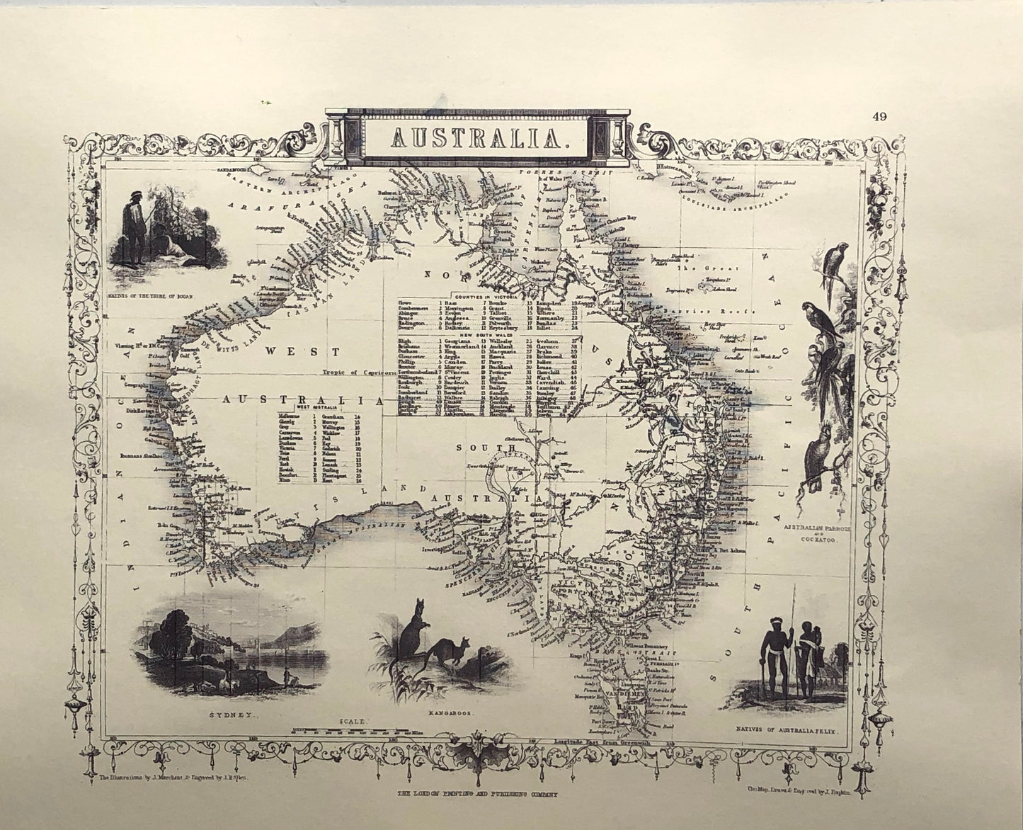
Map, Tallis John, Australia, This is a very good reproduction of the original in black and white
Map, Tallis John, Australia, This is a very good reproduction of the original in black and white
Couldn't load pickup availability
Date: 1851 Copy of Original Tallis Maps of Australia in black and white
Artist: John Tallis
Engraver: J Rapkin
Image Size: 270 x 350mms
Condition: Excellent
Technique: Reproduction Steel Engraving, uncoloured
Price: $100
Description: This map is a beautifully printed and hand coloured reproduction. Original Tallis maps were issued uncolored. It was not uncommon for 19th century libraries to commission colorists to "complete" the atlas. Due to the decorative style of Rapkin's work, many regard Tallis maps as the last bastion of English decorative cartography in the 19th century. Tallis Maps were characterised by decorative borders and vignettes on each map
Biography: Tallis, John, Cartographer
Share