Antiquarian Print Shop
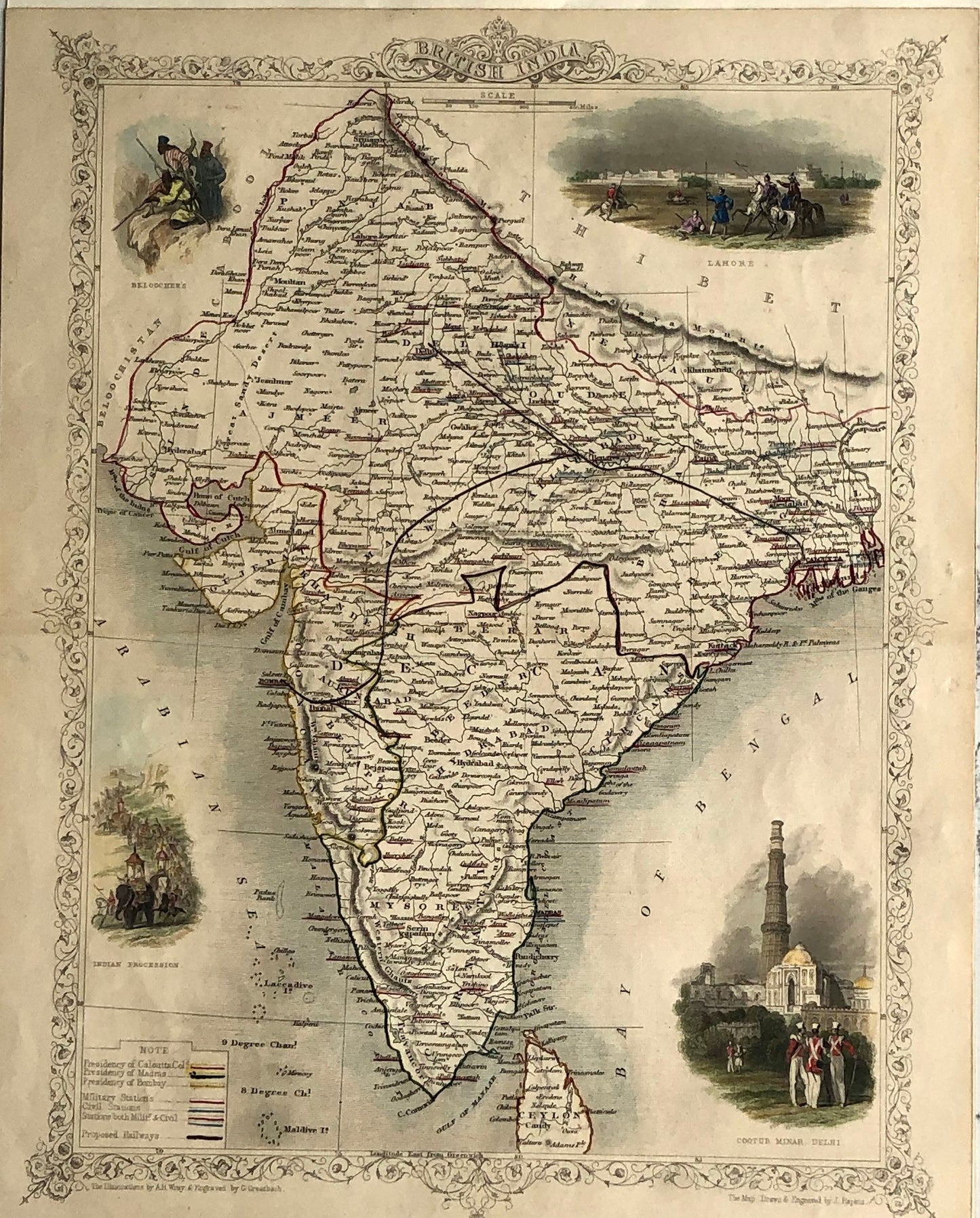
Map: Tallis John, British India, c1851
Map: Tallis John, British India, c1851
Couldn't load pickup availability
Date: 1851
Artist and Engraver: J Rapkin
Illustrations: H. Wray
Engraver: G. Greatbach
Image Size: 270 x 350mms
Condition: good
Technique: Steel Engraving, original hand coloured
Price: $400
Stock Number:
Description:
A highly decorative and detailed mid 19th century map of India (including Nepal) which was drawn and engraved by J. Rapkin (vignettes by A. H. Wray & G. Greenbach) and published in John Tallis's Illustrated Atlas (London & New York: c.1851). An interesting feature of the map is the depiction of the then proposed railway lines running from Bombay to Delhi and Calcutta. From the first opening in 1853, the railway network has become an integral feature of modern India. The Illustrated Atlas, published from 1849 to 1853, was the last decorative world atlas. The 'British India' map was typical of the many fine ones which appeared in this work with its decorative border and attractive vignettes. Illustrated are views of Lahore; Cootub Minar, Delhi; an Indian procession and Belouche tribesmen. Contained within an elaborate border, the maps are generally decorated with vignettes and scenes depicting particular views and local inhabitants.
Share