Antiquarian Print Shop
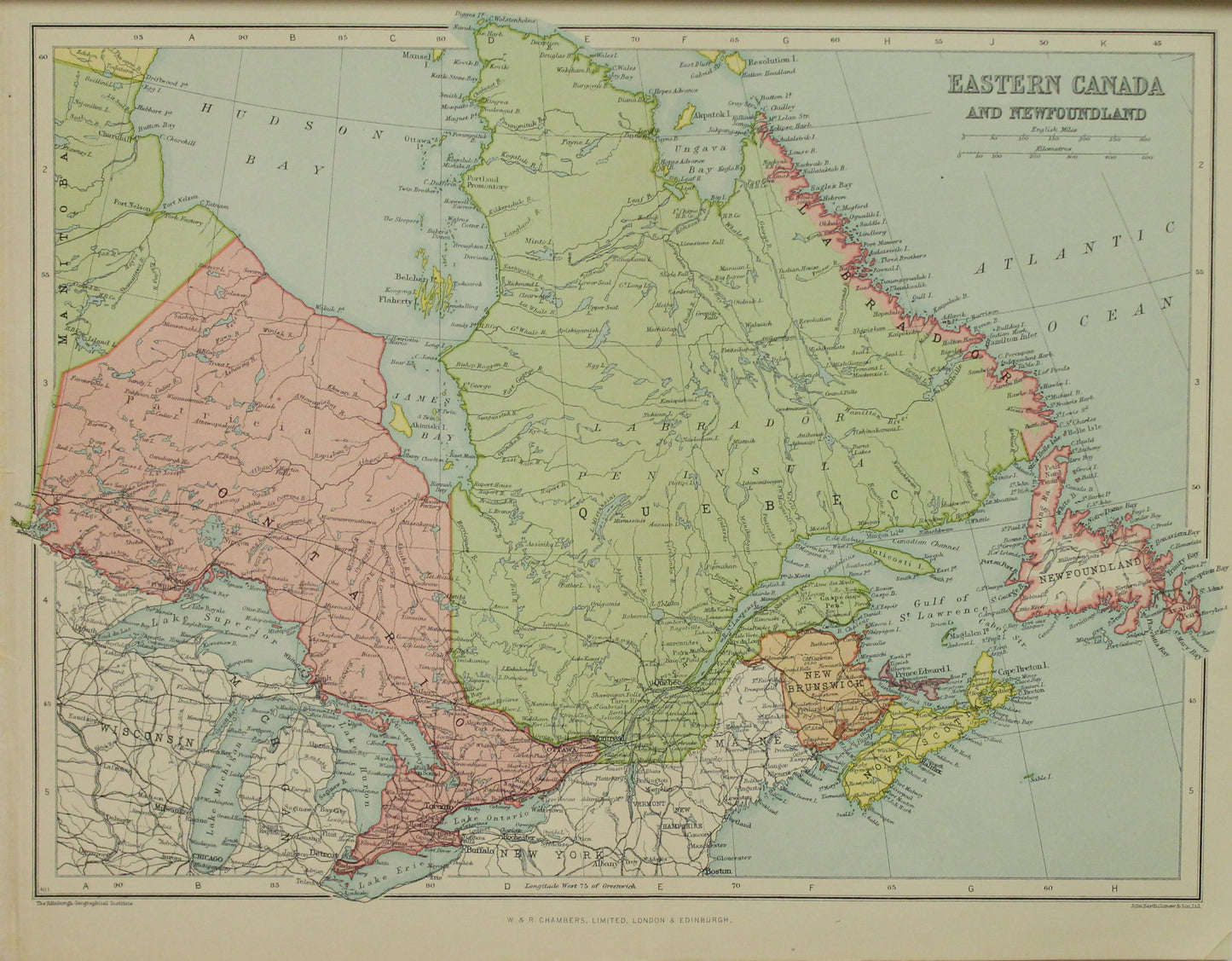
Map, Eastern Canada and Newfoundland, The Edinburgh Geographical Institute, John Bartholomew and Sons Ltd, W & R Chambers,
Map, Eastern Canada and Newfoundland, The Edinburgh Geographical Institute, John Bartholomew and Sons Ltd, W & R Chambers,
Couldn't load pickup availability
Map, The World Northern and Eastern Hemispheres, The Edinburgh and Geographical Institute, John Bartholomew & Son LTD, W & R Chambers, c1880,
Date: 1880
Geographer and Cartographer: John George Bartholomew and Son
Map Publishers: The Edinburgh Geographical Institute founded by John G Bartholomew
Publisher Author: W & R Chambers
Paper size: 270 x 335mm
Print size: 235 x 315mm
Condition: Very Good
Price: $200
Description: Original, Published in colour.
Provenance:
W and R Chambers, Publishers
Chambers was founded as W. & R. Chambers Publishers by the two brothers William Chambers of Glenormiston and Robert Chambers. They were born into a rich, mill-owning family in Peebles in Scotland in 1800 and 1802 respectively, during the time of the war with France. The war impoverished the family and, in 1813, the family left Peebles for Edinburgh. Robert remained at home to finish his education, but William was forced to find work to support his parents. He was a keen reader and would get up early in the morning to read by the dawn light because he was too poor to buy candles. He was apprenticed to a bookseller, at the sum of 4 shillings a week. Robert, also an avid reader, could not go to university when he finished school because his parents could not afford to pay. He too moved to Edinburgh, rented a one-roomed shop in Leith Walk, and set himself up as a bookseller when he was just 16 years old. William's apprenticeship came to an end when he turned 18 and he joined Robert working in the shop.
Between 1859 and 1868 they published their most important work to date, the renowned Chambers's Encyclopaedia (no longer published) in 520 weekly parts at three-halfpence each.[2] The first edition was based on a translation into English of the 10th edition of the German-language Konversations-Lexikon, which became the Brockhaus Enzyklopädie.[3] This went through several further editions, reaching a high point of quality with the 1950 edition published in 15 volumes by George Newnes which took six years to prepare, cost £500,000 and included the work of over 2,300 authors. The work was lauded by the then Lord Chancellor, Lord Jowitt, as "outstanding proof" of British scholarship, while the managing editor, M. D. Law, commented that she believed the work to be the first major encyclopaedia to be published in Britain since before the First World War.[4] The encyclopaedia was regarded as such a scholarly achievement that Law received the O.B.E. for her efforts.[5]
Chambers also published an extensive list of innovative and ultra-reliable language and reference titles, covering English-language dictionaries, thesauruses, bilingual dictionaries, and specialist titles on subjects such as biography, quotations, literary characters, science and technology and world history.
In 1989, Chambers was acquired by Groupe de La Cite.,[6] part of CEP. Chambers purchased the formerly independent George G. Harrap and Co. in 1992. Harrap mainly publishes bilingual dictionaries, for instance Harrap's Shorter French Dictionary. The Harrap list also includes study aids, slang dictionaries, phrasebooks and business dictionaries. In the UK, Harrap publishes bilingual titles in French, Spanish, Portuguese, Italian, German and Polish.
Havas acquired CEP in 1997; Havas was then acquired by Vivendi in 1998. Vivendi sold its European book publishing to Lagardère Group in 2002.[7]
At the end of 2009, the parent company shut the Edinburgh premises of Chambers Harrap Publishers. The Chambers imprint was managed from London by Hodder Education, while Harrap titles were moved to Larousse in Paris.[8] Chambers was moved to the John Murray division of Hodder in 2013.
Wikipedia
The Edinburgh And Geographical Institute
John Bartholomew and Son Ltd
Publisher: WR Chambers
Around 1826 John Bartholomew Sr. opened a firm dedicated to the production of maps called 'John Bartholomew and Sons'. In 1888, John George Bartholomew, having taken over the company and hoping to create 'a site for the promotion of national geographic knowledge', renamed the publishers to the 'Edinburgh Geographical Institute'.[1]
With the demolition of John's family home, Falcon Hall, the Palladian façade was removed to a new site on Duncan Street in the Newington district of Edinburgh, to serve as the façade of the new Edinburgh Geographical Institute. The name was inscribed into the stone and remains there to this day.
Until 1962 the firm was the Geographer and Cartographer to the King for Scotland.
The Institute continued to produce high quality maps from their new premises until 1989 when they merged with the Glasgow publisher Collins, as part of the multinational HarperCollins Publishers, where the name lives on as Collins Bartholomew, a map publishing subsidiary of HarperCollins.
In 1995, the office in Duncan Street was closed; however, the building remains there to this day and still bears the Edinburgh Geographical Institute name.
Share


