[{"id":428501205306,"handle":"entire-print-collection","title":"Entire Print Collection","updated_at":"2023-01-26T12:25:12+10:00","body_html":"","published_at":"2022-11-22T13:42:49+10:00","sort_order":"alpha-asc","template_suffix":"","disjunctive":false,"rules":[{"column":"variant_price","relation":"less_than","condition":"10000"},{"column":"type","relation":"not_contains","condition":"Gift Cards"},{"column":"vendor","relation":"not_contains","condition":"Printify"}],"published_scope":"global"},{"id":58302103638,"handle":"maps","title":"Maps Prints","updated_at":"2022-12-19T10:14:20+10:00","body_html":"\u003cp\u003eFrom the journeys of early Roman explorers, man has been mapping the Earth to allow others to follow their paths. Explorers like James Cook, Mathew Flinders and William Dampier relied on the cartographers to steadily map their courses and document their discoveries.\u003c\/p\u003e","published_at":"2018-10-13T13:13:19+10:00","sort_order":"alpha-asc","template_suffix":"","disjunctive":true,"rules":[{"column":"tag","relation":"equals","condition":"Maps"},{"column":"title","relation":"contains","condition":"Maps"}],"published_scope":"global","image":{"created_at":"2018-10-14T17:34:21+10:00","alt":"","width":1080,"height":1080,"src":"https:\/\/cdn.shopify.com\/s\/files\/1\/1617\/1641\/collections\/IMG_2107.jpg?v=1661380119"}},{"id":428112052538,"handle":"under-200","title":"Prints Under $200","updated_at":"2023-01-26T12:25:12+10:00","body_html":"Prints under $200.","published_at":"2022-11-17T14:05:39+10:00","sort_order":"best-selling","template_suffix":"","disjunctive":false,"rules":[{"column":"variant_price","relation":"less_than","condition":"200"},{"column":"vendor","relation":"not_contains","condition":"Printify"}],"published_scope":"global"},{"id":428112085306,"handle":"under-300","title":"Prints Under $300","updated_at":"2023-01-26T12:25:12+10:00","body_html":"Prints under $300.","published_at":"2022-11-17T14:07:28+10:00","sort_order":"best-selling","template_suffix":"","disjunctive":false,"rules":[{"column":"variant_price","relation":"less_than","condition":"300"},{"column":"vendor","relation":"not_contains","condition":"Printify"}],"published_scope":"global"},{"id":428112281914,"handle":"under-400","title":"Prints Under $400","updated_at":"2023-01-26T12:25:12+10:00","body_html":"Prints under $400.","published_at":"2022-11-17T14:13:11+10:00","sort_order":"alpha-asc","template_suffix":"","disjunctive":false,"rules":[{"column":"variant_price","relation":"less_than","condition":"400"},{"column":"vendor","relation":"not_contains","condition":"Printify"}],"published_scope":"global"}]
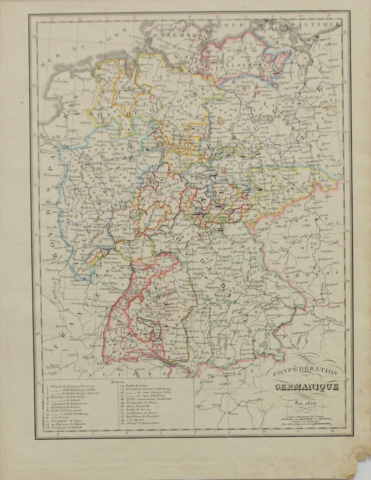
Map, Lapie, Pierre and Alexandre, Confederation Germanique, c1829
Regular price
$150.00
Sale
Maps, Confederat Germanoique for Pierre & Alexandre Lapie's Atlas Universel de Geograrphie Ancienne et Moderne.
Date: c1829
Cartographer: Lapie, Pierre & Alexandre
Image Size: 215 x 285mm
Paper Size: 250 x 335mm
Condition: Good
Technique: Lithograph
Price: $150
Description: Copperplate Engraving with later hand colouring
Biography:
Lapie, Pierre M (1779 – 1850) and Son Alexandre Emile Lapie (1809 – 1850) Pierre M. Lapie (fl. 1779 - 1850) and his son Alexandre Emile Lapie (fl. 1809 - 1850) were French cartographers and engravers active in the early part of the 19th century. The Lapies were commissioned officers in the French army holding the ranks of Colonel and Capitan, respectively. Alexander enjoyed the title of First Geographer to the King", and this title appears on several of his atlases. Both father and son were exceptional engravers and fastidious cartographers. Working separately and jointly they published four important atlases, an 1811 Atlas of the French Empire (Alexander), the 1812 Atlas Classique et Universel (Pierre), the Atlas Universel de Geographie Ancienne et Modern (joint issue), and the 1848 Atlas Militaire (Alexander). They also issued many smaller maps and independent issues. All of these are products of exceptional beauty and detail. Despite producing many beautiful maps and atlases, the work of the Lapie family remains largely underappreciated by most modern collectors and map historians. The later 19th-century cartographer A. H. Dufour claimed to be a student of Lapie, though it is unclear if he was referring to the father or the son. The work of the Lapie firm, with its precise engraving and informational density, strongly influenced the mid-19th century German commercial map publishers whose maps would eventually dominate the continental market.