1
/
of
1
Antiquarian Print Shop
Map, Steiler Adolf, Eastern Hemisphere, Steilers Hand Atlas, c1862
Map, Steiler Adolf, Eastern Hemisphere, Steilers Hand Atlas, c1862
Regular price
$500.00 AUD
Regular price
Sale price
$500.00 AUD
Unit price
/
per
Taxes included.
Shipping calculated at checkout.
Couldn't load pickup availability
Full Name of Map
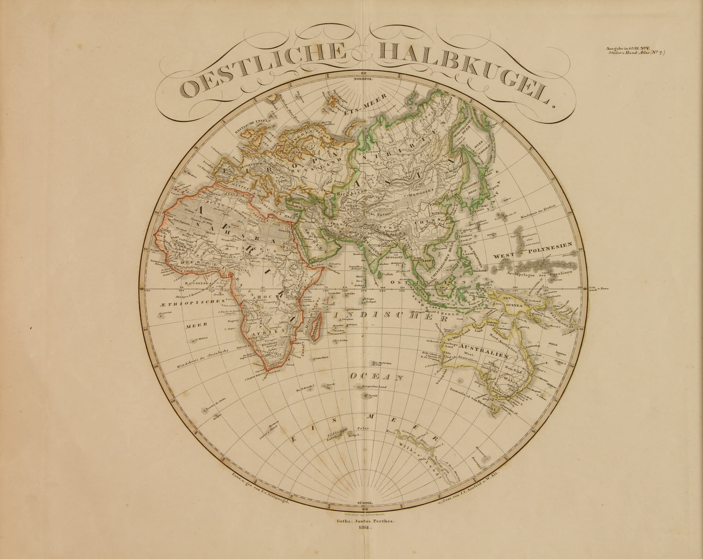
Oestliche Halbrugel: Steiler, Adolf, 1862
Date: 1861
Artist: Adolf Steiler
Engraver: Adolf Steiler
Paper Size: 460 x 370mms
Condition: good
Technique: steel engraving
Price: $500
Description: The mark across the bottom portion of this map is a shadow. This map is in good condition. It will be photographed again in due course
Eastern Hemisphere
Oestliche Halbrugel: Steiler, Adolf, 1861
Full Title of Map: Oestliche Halbkugel Gotha: Justus Perthes 1861
Author: Steiler, Adolf
Date: 1861
This is a rare historical cartographic image from Steilers Hand Atlas of 1861
Short Title: Westliche Halbkugel
Publisher: Gotha: Justus Perthes
Type: Atlas Map
Object Height cm: 32
Object Width cm: 36
Scale 1: 37,000,000
Note: In outline hand colour
World Area: Eastern Hemisphere
Engraver or Printer: Stieler Adolf
Published In: Hand Atlas Uber Alle Theile Der Erde Und Uber Das Weltgebaude. Herausgegeben Von Adolf Steiler. Gotha Justus Perthes.
Publication Author: Steiler, Adolf
Publication Date: 1861
Publication Note: Stieler's Atlas is extraordinarily detailed. Close examination of the maps shows many features that one would expect to find only on much larger maps. This atlas was first published in 1817, with editions continuing well into the 20th century. It was one of the most comprehensive and best executed 19th century German atlases. In this edition, the maps are dated 1861 Phillips says this was issued in parts. 8 pages of text accompanies the index. Atlas is bound in half leather brown cloth covered boards with "Steiler's Hand Atlas" stamped in gilt on the front cover and spine. Maps are both hand painted and printed in full and outline color.
Publication Type: World Atlas
Publication Maps: 89
Publication Height cm: 40
Publication Width cm: 50
Share