Antiquarian Print Shop
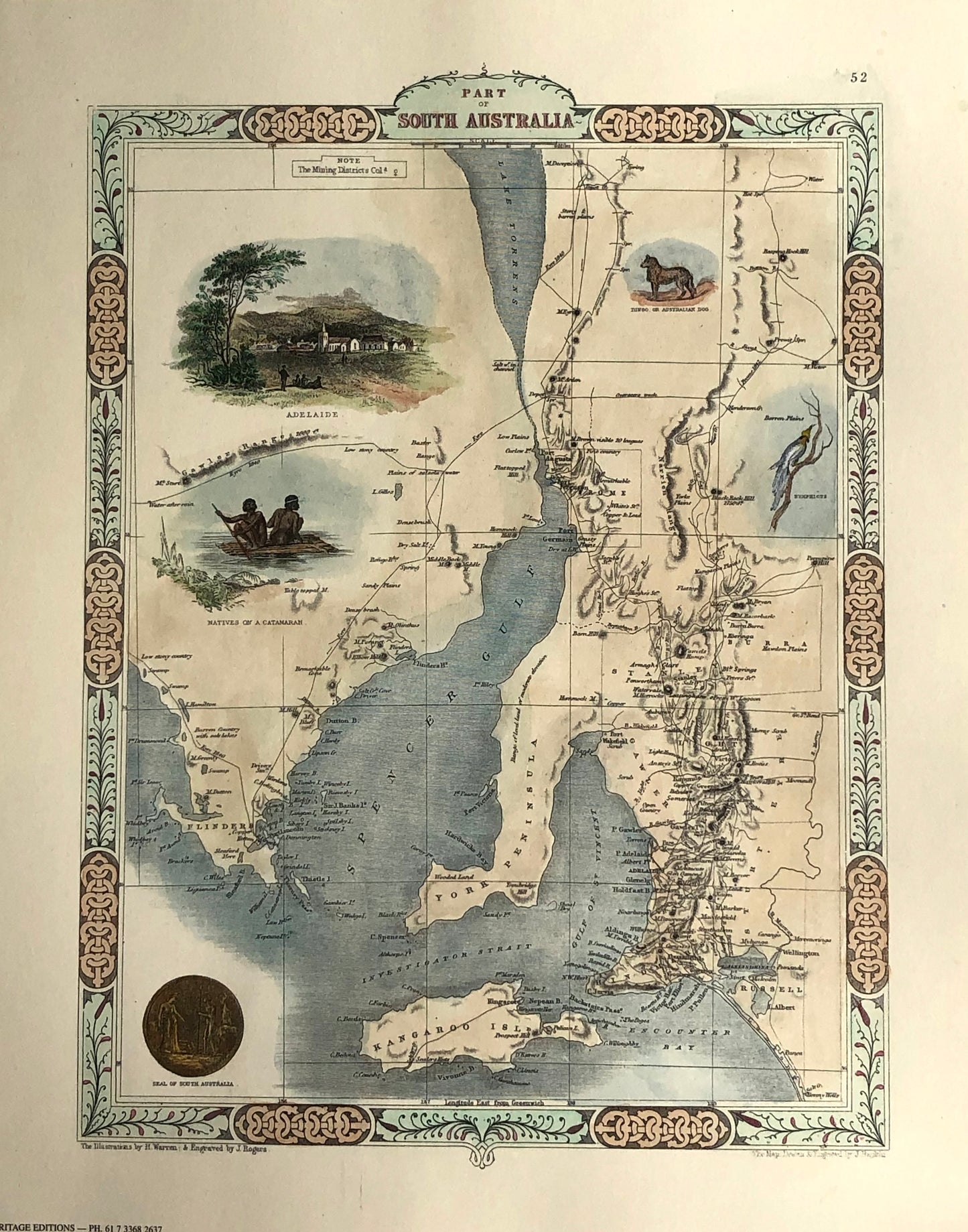
Hand coloured reproduction map of South Australia by John Tallis
Hand coloured reproduction map of South Australia by John Tallis
Couldn't load pickup availability
REPRODUCTION
Date: c1851
Artist: Tallis John
Illustrations: Warren
Engraver: Rapkin John and Rogers J
Paper Size: 370 x 270mms
Condition: good
Technique: Steel engraving
Price: $120
Description:
Biography:
John Tallis (7th November 1817- 3rd June 1876) was among one of the most renowned British cartographers, map makers, and publishers of the 19th Century. His maps are works of art as much as geography
Born in Stourbridge and worked as a publisher in Birmingham in the Midlands, until he moved to London in the early 1840s. Tallis began his London career with a series of remarkable London street views. He began a partnership with Frederick Tallis, possibly his brother, but their collaboration ended in 1849.
He lived in New Cross, South East London. His house on New Cross Road is listed as a Building of Special Architectural or Historic Interest, grade II. It has a blue plaque on the wall to signal the event.
For the Great Exhibition of 1851, Tallis published the Illustrated World Atlas, one of the last series of decorative world maps ever produced. The maps were engraved by John Rapkin, a skilled artisan. The maps from "The Illustrated Atlas" were first issued in 1851 to commemorate the Great Exhibition in London and are considered the last series of decorative maps of the world, combining fine cartographical detail within an elaborate and attractive border.
The maps were later reissued by the London Printing & Publishing Company, who left the Tallis imprint intact, thus ensuring his enduring fame. In 1858, he began publication of the popular Illustrated News of the World and National Portrait Gallery of Eminent Personages
His company, John Tallis and Co traded between 1838 and 1851
These atlas maps were first published in serial form to a target audience for which the expense and hardship of travel were prohibitive. The progress of the 19th Century brought swift and dramatic changes in public awareness of faraway places. Tallis maps are likely to have played an important role in this dramatic awakening. His maps not only provided up-to-date geographical knowledge, but their beautiful vignette views showed the native people, their occupations, cities, and points of interest. These maps remind us of the beautiful cartographic tradition of the 17th Century Dutch Mapmakers with their finely engraved decorative borders
At some point, John Tallis made the acquaintance of John Rapkin, an engraver of some note who was an inspiration to John Tallis. His amazing illustrations enabled the maps that they produced to be beautiful illuminative works of art.
Illustrated Atlas of the World, published in 1849 with the maps and decorative vignettes engraved and drawn by John Rapkin, was one of the last atlases to be truly decorated and is therefore highly prized. The maps were uncoloured although when sold, colourists were frequently employed to add tints to them
Rapkin’s maps included views drawn and engraved by a number of prominent artists. The maps were issued as a complete volume from 1851 until about 1865. Some of the maps were also published in other history books published by Tallis including the British Colonies and, without the vignettes, in geographical dictionaries and encyclopedias until about 1880.
John Rapkin’s work inspired John Tallis and they used travelogues extensively as a guide as he produced vignettes and ornamental engravings to embellish the Tallis maps.
Share