Antiquarian Print Shop
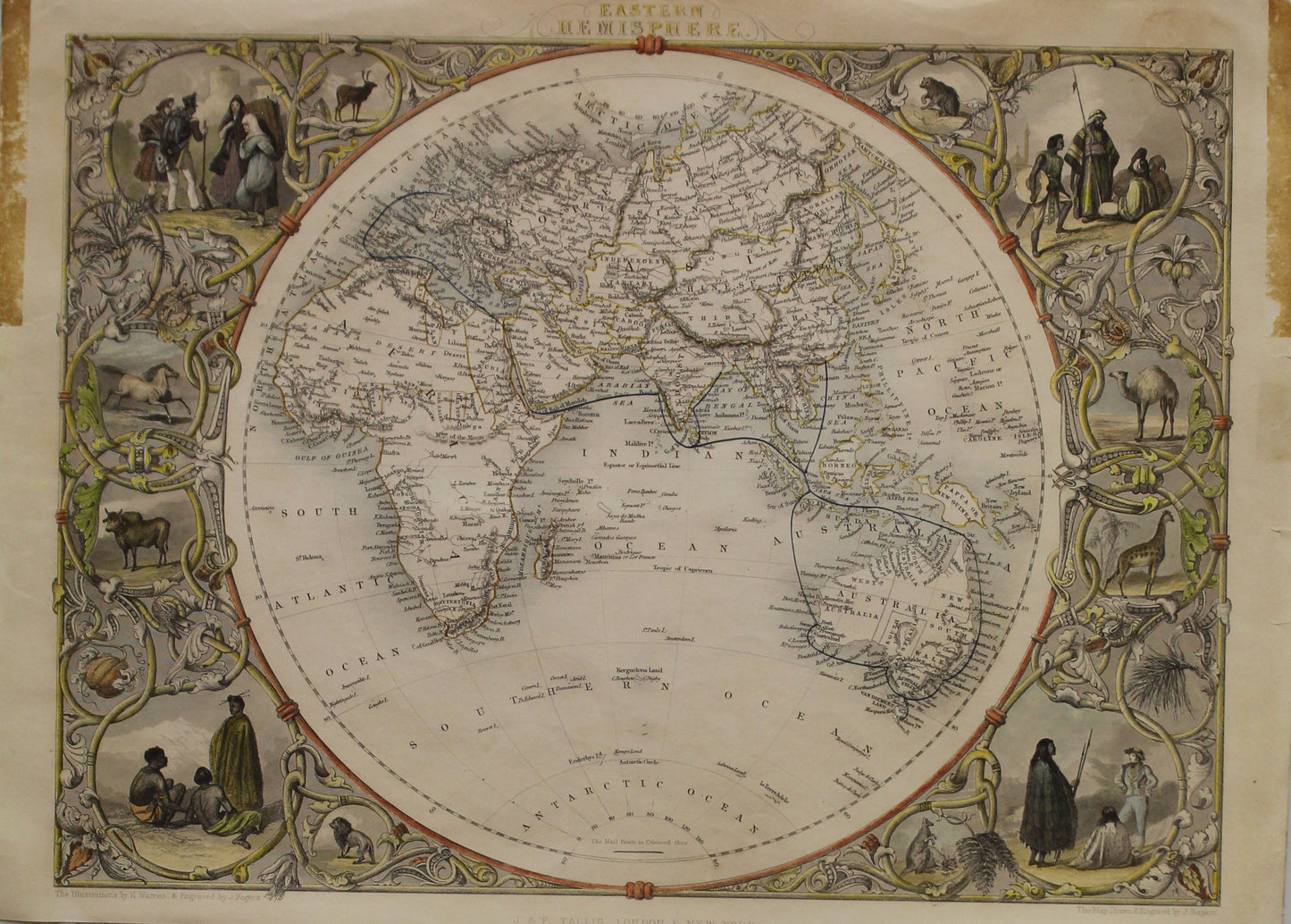
Map, Eastern Hemisphere, Tallis, John, J. Rapkin, c1851
Map, Eastern Hemisphere, Tallis, John, J. Rapkin, c1851
Couldn't load pickup availability
Original Tallis Map of the Eastern Hemisphere
Date: 1851
Artist: John Tallis
Engraver: J Rapkin
Image Size: 270 x 360cms
Condition: Good. This map has glue marks on the extremities of the paper from the use of the non-acid-free tapes during earlier framing. Some marks on the paper but most will not be seen after this map has been framed.
Technique: Steel Engraving, later hand coloured
Price: $650
Description: Original Tallis maps were issued uncoloured. It was not uncommon for 19th century libraries to commission colourists to "complete" the atlas.
Due to the decorative style of Rapkin's work, many regard Tallis maps as the last bastion of English decorative cartography in the 19th century. Tallis Maps were characterised by decorative borders and vignettes on each map.
Biography: Tallis, John, Cartographer
Share