Antiquarian Print Shop
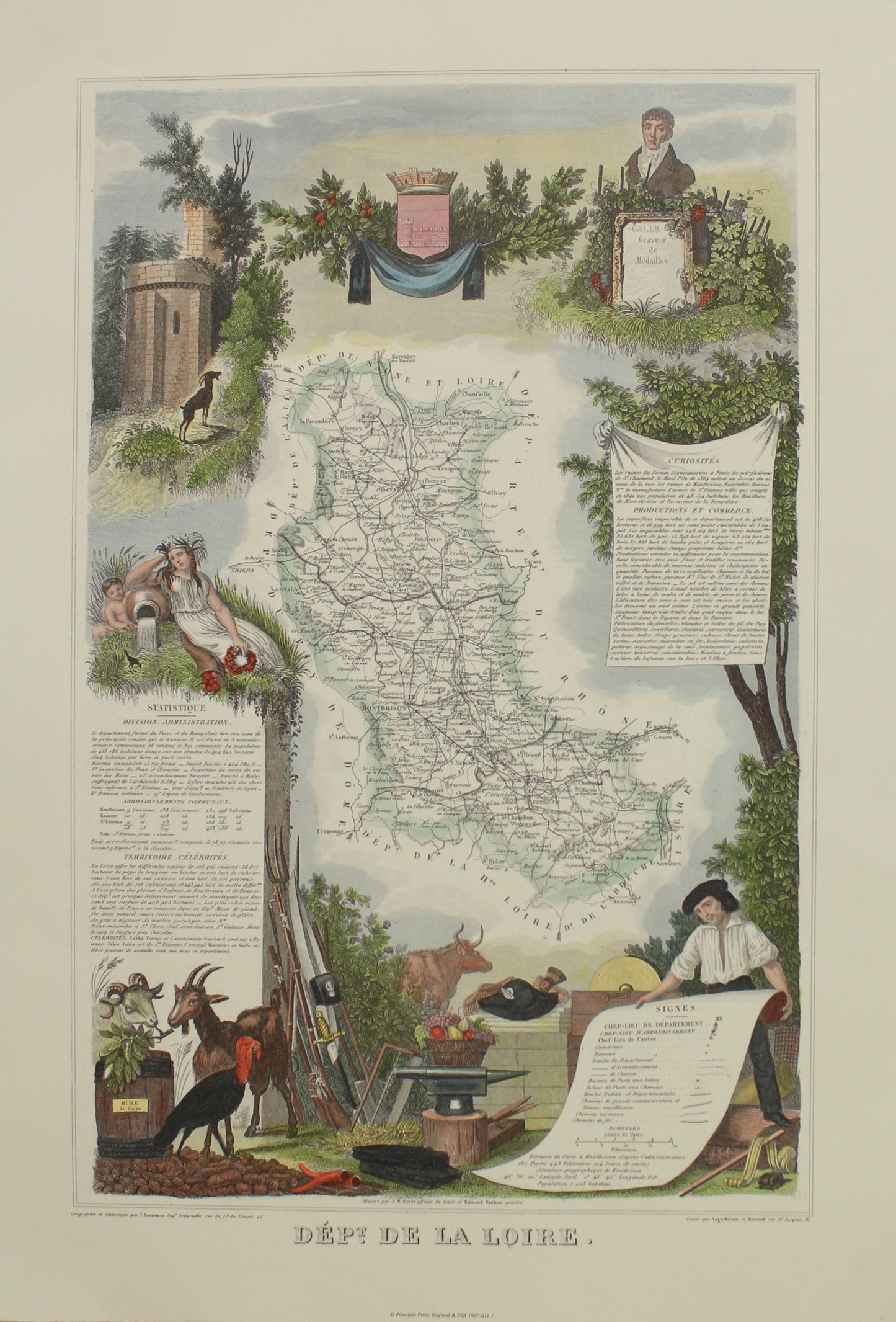
Map, French Wine Map, Dept De La Loire, Atlas National De La France Illustre, REPRODUCTION, c 1854
Map, French Wine Map, Dept De La Loire, Atlas National De La France Illustre, REPRODUCTION, c 1854
Couldn't load pickup availability
Date: c1854
Geographer:
Engraver: Levasseur V
Paper Size: 350 x 500mm
Print Size: 280 x 440mm
Condition: Good
Technique: Copperplate engraving
Price: $200
Description: Good Copperplate engraving with hand colouring. This is a beautiful
decorative reproduction
Provenance
Antique reproduction of the map titled 'Dépt. De La Loire. Map of the French department of Loire, France. This area of France is part of the Loire Valley wine-growing region The whole is surrounded by elaborate decorative engravings designed to illustrate both the natural beauty and trade richness of the land. There is a short textual history of the regions depicted on both the left and right sides of the map. This map originates from ‘Atlas National de la France Illustré’. Published by A. Combette, Paris, 1854.
To read about Victor Levasseur click here
Share