Antiquarian Print Shop
Map, Morden Robert, County Map, Northumberland, c1695
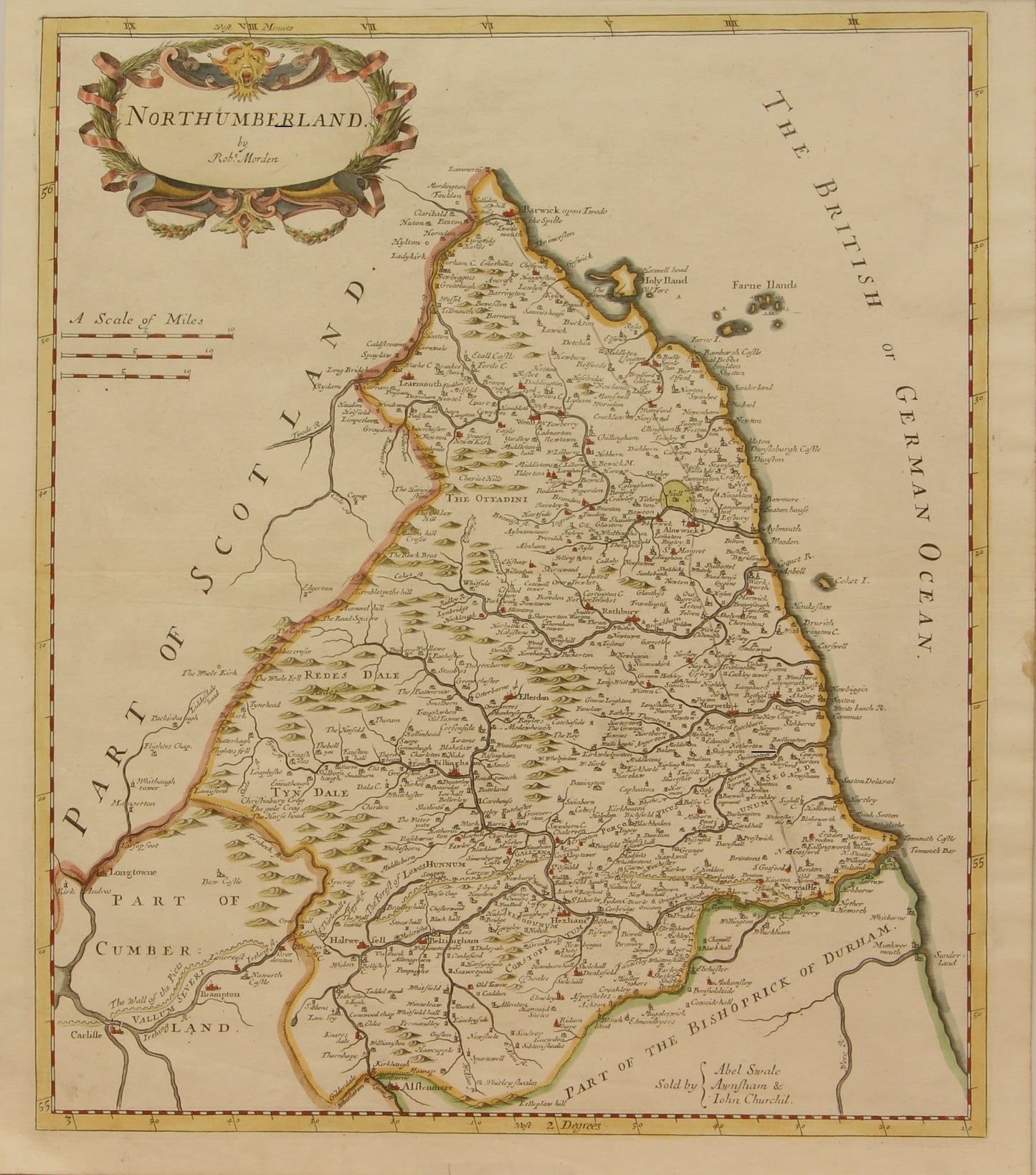
Map, Morden Robert, County Map, Northumberland, c1695
Couldn't load pickup availability
Date: c1695
Artist: Morden Robert
Print Size: 420 x 365mm
Condition: very good
Technique: Copperplate
Price: $1500
Description: Copperplate Engraving, hand-coloured, original
Provenance:
This original county map of Northumberland by Robert Morden was published by Awnsham in 1695 and is an early county map to show the county roads. It presents a good view of the city of London and the Thames River along with the locations of towns, buildings, forests, rivers, bridges, and parks, which are noted by fenced areas. There is a decorative cartouche and three different distance scales. Sold by Swale, Awnsham & John Churchill
Morden was one of the first English cartographers to show longitudes measured from the meridian of St. Paul's Cathedral (shown in degrees at the bottom of the map) and time in minutes measure locally from the sun (shown at the top). The roads on his maps are based on Ogilby's earlier survey. The Britannia was first published by historian William Camden (1551-1623) in 1586. After the publication of the final edition of Britannia in 1637, the work was not published again until 1695 when Gibson revised and translated the text from the original Latin and included fifty maps, mostly of the English counties, prepared by Robert Morden, replacing the outdated maps of Christopher Saxton. This map is from the subsequent edition of 1722.
Good hand colouring
Guaranteed to be over 320 years old
Biography: Cartographer
- Reference: Wikipedia
- Born: 1650 · England
- Died: 1703 · England
| 1687: | He also produced a series of miniature maps of the world, which appeared in both playing card format and in a series of atlases, including his Atlas Terrestris and Geography Anatomiz'd, beginning in 1687. |
| 1695: | In 1695 he published a map of Scotland. |
| 1700: | His (fourth edition) of Geography Rectified: or a Description of the World from 1700 dedicated to a Thomas Goddard, is a comprehensive work from many aspects. |
| 1701: | Morden also produced in 1701 a series of smaller county maps often known as Miniature Mordens. |
| 1702: | An introduction to astronomy, geography, navigation, and other mathematical sciences written by Robert Morden was first published in 1702. |
| 1703: | Between about 1675 and his death in 1703, he was based under the sign of the Atlas at premises in Cornhill and New Cheapside, London. |
Share