1
/
of
1
Antiquarian Print Shop
Map, Tallis John, Northern India, c1851
Map, Tallis John, Northern India, c1851
Regular price
$400.00 AUD
Regular price
Sale price
$400.00 AUD
Unit price
/
per
Taxes included.
Shipping calculated at checkout.
Couldn't load pickup availability
Date: 1851
Artist: Tallis John
Engraver: Rapkin
Vignettes: Wray T
Image Size: 270 x 350mm
Condition: good
Technique: original steel engraving, hand coloured
Price: $400
Description:
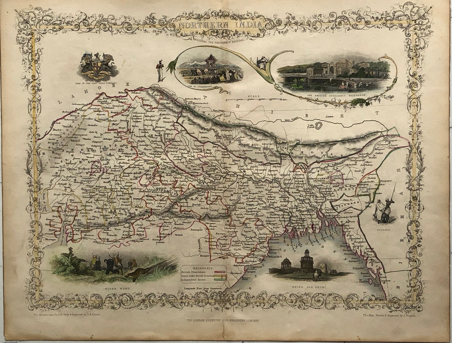
A highly decorative Map titled 'NORTHERN INDIA' issued by John Tallis.
Striking full color example of this marvelous map. Showing vignettes of The British Residency, Hyderabad, Ruins, Old Delhi, Also the coat of Arms Auspicio/Anolie. Engraved for R. Montgomery Martin's Illustrated Atlas. Tallis was one of the last great decorative map makers. His maps are prized for the wonderful vignettes of indigenous scenes, people, etc. Remarkable color.
Contained within an elaborate border, the maps are generally decorated with vignettes and scenes depicting particular views and local inhabitants.
This map was drawn and engraved by John Rapkin while the illustrations are drawn and engraved by H. Winkles.
Contained within an elaborate border, the maps are generally decorated with vignettes and scenes depicting particular views and local inhabitants.
This map was drawn and engraved by John Rapkin while the illustrations are drawn and engraved by H. Winkles.
CARTOGRAPHER
John Tallis and Company published views, maps and Atlases in London from roughly 1838 to 1851. The principal works, expanding upon the earlier works of Cary and Arrowsmith, include an 1838 collection of London Street Views and the 1849 Illustrated Atlas of the World. His principal engraver was John Rapkin, whose name and decorative vignettes appear on most Tallis & Co. maps. Due to the decorative style of Rapkin's work, many regard Tallis maps as the last bastion of English decorative cartography in the 19th century. Though most Tallis maps were originally issued uncolored, it was not uncommon for 19th century libraries to commission colorists to "complete" the atlas. The London Printing and publishing Company of London and New York bought the rights for many Tallis maps in 1850 and continued Publishing his Illustrated Atlas of the World until the mid 1850s. Specific Tallis maps later appeared in innumerable mid to late 19th century publications as illustrations and appendices.
Source:
- Tallis J., The Illustrated Atlas, And Modern History Of The World Geographical, Political, Commercial & Statistical, 1851.
Share